
Irvine Valley Trails
The Irvine Valley has a long history of providing its communities with the opportunity to explore the countryside. With around 120 miles (200km) of trails throughout the valley, there is a mix of historic Rights of Way, more recently built paths, a network of core paths, and some paths that you will only hear about with local knowledge!
Sections of the Irvine Valley Trails were upgraded in 2023 and we are keen to find out if these improvements have changed the amount of people using the path and the ways in which they are being used.
If you are a user of the paths that form part of the Irvine Valley Trails, we would be grateful if you could spare a few moments to complete a short survey and give us your feedback.
https://www.smartsurvey.co.uk/s/IVT2025/
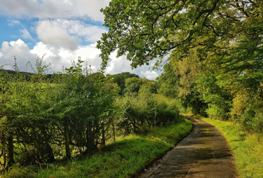
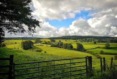
The Irvine Valley Trail lets people get out into the countryside to enjoy the beautiful views of the valley. It is an outdoor enthusiast’s paradise of trails and quiet country roads that anyone can enjoy. With the River Irvine running through the spine of the valley, and its high open moorlands, pockets of beautiful native woodland, and rolling hills, the valley is also home to a whole host of flora and fauna for the visitor to enjoy.
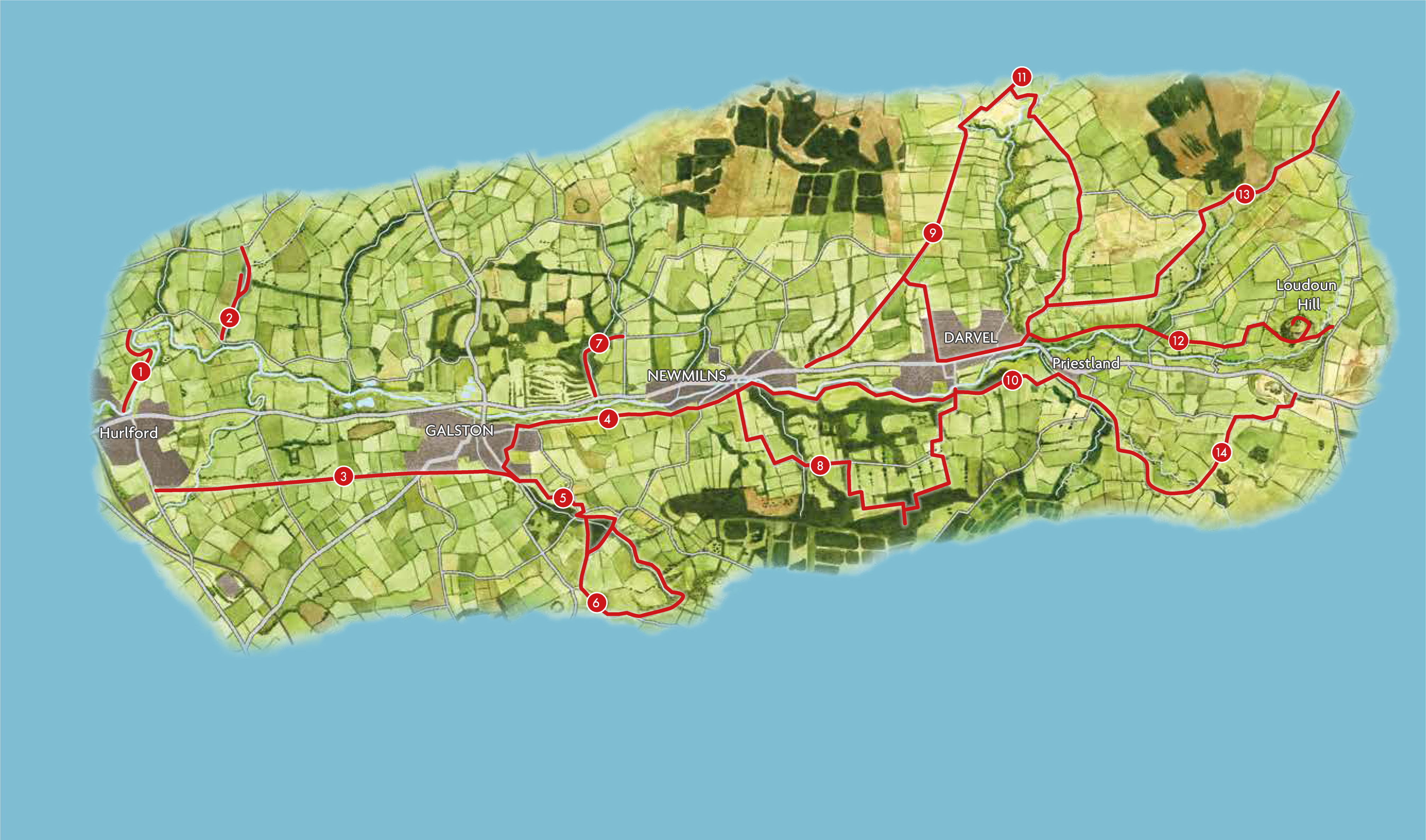
The trails link up the communities of Hurlford in the west, through Galston and Newmilns, to Darvel and Loudoun Hill in the east. They also give people access to Whitelee Wind Farm in the north, the River Ayr Way in the south, Kilmarnock in the west, and Strathaven with its surrounding settlements in the east.
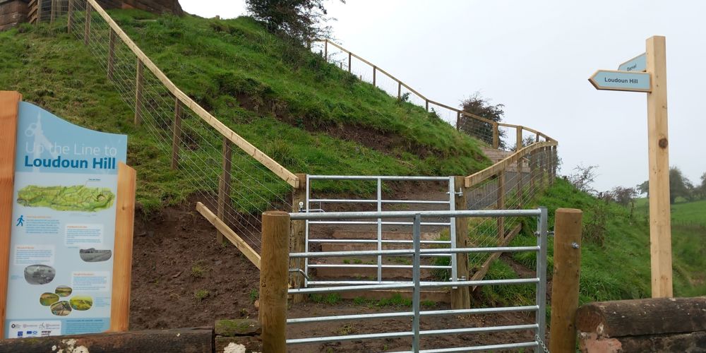
There are 14 Valley Trails (illustrated in the map below) which can be walked individually or can be linked up to create longer routes. The distances of each individual walk vary in distance and difficulty and more details can be found by downloading the Trails leaflet using the link below. The paths are signposted and there is interpretation along the way so there is lots to discover and read about on the way.
Read more on the Herald's website about the route
The Irvine Valley Trails also featured on the BBC's Grand Tours of Scotland's Rivers - watch it here
The Irvine Valley Trails Project
The Irvine Valley Regeneration Partnership in conjunction with East Ayrshire Council and Ayrshire Leader commissioned Ironside Farrar Environmental Consultants to carry out a study of the path network. The study produced the Irvine Valley Path Network Route Assessment (Priorities, Standards and Proposals) which was used to drive the Irvine Valley Trails Project. This included
- A successful consultation in which the public, key stake holders and landowners commented on the proposals put forward in the Irvine Valley Path Network Route Assessment document.
- Surveying routes and estimated remedial and construction costs for development work.
- Mapping existing routes.
- Liaising with landowners and key stakeholders to take the proposals forward and decide a schedule of work.
- Consideration of additional routes that have been identified since the original study and added maps to the database.
- Working closely with Ayrshire Roads Alliance to develop any potential cycle ways in the valley.
- Developing a brand identify for the route
Works were completed in 2023 and the Trails are waiting to be explored.

Annual Walking Festival
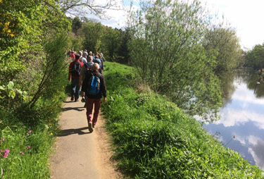
The people who call 'the valley' home are proud of where they come from and take pride in their walking heritage. So much so there is even an annual walking festival! The festival has been running every May since 2002 and attracts hundreds of walkers to take part in a programme of led walks for all abilities. It’s a great opportunity to explore the area and get to know its history better with the locals who know it best.